
Explore our diverse portfolio showcasing innovative projects across mapping, surveying, and geospatial solutions. Each designed with precision, technology, and creativity to deliver impactful results for clients across various industries and sectors.
We’re here to help you with clear advice and support. Reach out today and let’s connect.
The project aimed to ensure that the construction of the ultra-modern hostel facility at Lagos State University (LASU) conformed precisely to the architectural and structural designs. This involved setting out the foundational elements, walls, and infrastructure, ensuring they adhered to the planned dimensions and orientations.
By ensuring strict conformity with the architectural and structural designs, the project significantly reduced the risk of construction errors, thus saving time and costs associated with potential corrections. The accurate setting out laid a solid foundation for the project, ensuring that the hostel facility would meet the highest standards of safety, functionality, and aesthetic appeal. This precision contributed to the long-term durability and usability of the facility, providing a modern and comfortable living space for students.
The aim of this bathymetric survey was to provide detailed underwater topographical data to support the construction of a jetty at Ladol, Snake Island. This survey was crucial for understanding the underwater terrain, identifying any potential obstacles, and determining the most suitable locations for jetty construction.
The bathymetric survey delivered high-precision data that was instrumental in guiding the jetty construction process. By accurately mapping the underwater landscape, the project ensured that construction activities could proceed safely and efficiently, minimizing the risk of encountering unforeseen challenges during the build. This proactive approach helped in reducing project delays, optimizing construction costs, and ensuring the long-term stability and functionality of the jetty.
This project aimed to provide a comprehensive aerial overview of a 2,000-hectare property earmarked for real estate development in Asaba, Delta State. The goal was to facilitate proper planning, land reclamation, and development by offering detailed and accurate mapping data.
The aerial mapping delivered a precise and comprehensive overview of the property, enabling the client to make informed decisions about land use, zoning, and development plans. The data provided valuable insights for land reclamation efforts, ensuring that the land was optimized for real estate development. This mapping also supported efficient project planning, helping to avoid potential issues related to land use and ensuring that the development proceeded smoothly and in alignment with regulatory standards.
The project aimed to utilize LiDAR technology to map the runway and surrounding premises of Ibadan Airport. This mapping was critical for infrastructural planning, runway inspection, and slope determination to ensure the airport’s facilities met safety and operational standards.
The LiDAR mapping provided highly accurate and detailed topographical data, essential for the airport’s infrastructure planning and maintenance. By identifying any irregularities in the runway surface and surrounding areas, the project helped in ensuring the safety of aircraft operations. The slope determination data was particularly valuable for assessing drainage and runoff, thereby contributing to the airport’s long-term operational efficiency and safety. This precision mapping supported the airport’s ongoing development and modernization efforts, ensuring it met both current and future demands.
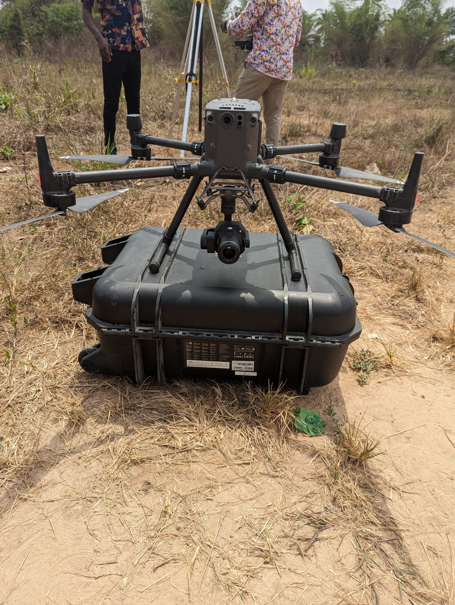
The aim of this project was to conduct a UAV-based visual inspection of the ongoing road rehabilitation works in Ikoyi, Lagos. The focus was on monitoring the progress, inspecting the quality of work, and providing project milestone updates for effective project control.
The UAV-based visual inspection offered real-time, high-resolution imagery of the road rehabilitation project, enabling the client to monitor progress with exceptional detail. This approach facilitated early detection of potential issues, allowing for timely interventions and ensuring that the project remained on track. The project milestone updates provided by the UAV inspections allowed for better project control and decision-making, helping to avoid delays and cost overruns. Overall, the use of UAV technology enhanced the efficiency, accuracy, and transparency of the road rehabilitation process, ensuring that the final outcome met the highest standards of quality.
The objective of this project was to conduct topographical and aerial mapping of a proposed site for an oil and gas tank farm in Abia State, Nigeria. The goal was to provide comprehensive and precise terrain data to support the planning, design, and construction of the tank farm.
The topographical and aerial mapping delivered accurate and detailed data on the site’s terrain, including elevation, contours, and natural features. This information was crucial for the effective planning and design of the tank farm, ensuring that the site was suitable for development and that potential challenges, such as uneven terrain or flood-prone areas, were identified early. The data also supported the safe and efficient layout of the tank farm, helping to optimize the use of space and resources while ensuring compliance with environmental and safety regulations. By providing a clear understanding of the site’s characteristics, the project facilitated informed decision making, reduced the risk of costly design errors, and contributed to the successful and timely development of the tank farm.
 Optimized by Seraphinite Accelerator