The Role of UAVs and Drones in Modern Surveying
Surveying has always been essential for infrastructure, construction, and land development. Traditionally, surveyors used manual measurements and ground-based equipment. While this was effective, it often took a lot of time, required significant labor, and was subject to human error. Today, in a fast-paced world, Unmanned Aerial Vehicles (UAVs), commonly called drones, are changing how surveying is done, especially in Nigeria, where rapid development requires accuracy, efficiency, and innovation. Why Drones Are Transforming Surveying UAVs use aerial imaging, sensors, and GPS technologies to gather high-resolution geospatial data. These tools enable surveyors to cover large areas quickly. They also help create detailed maps and provide insights with remarkable precision. Applications of UAVs in Surveying Topographic SurveysDrones collect detailed elevation data and create accurate 3D terrain models. This information assists engineers in designing infrastructure projects with a clear understanding of land features. Construction Progress MonitoringWith real-time aerial images, project managers can monitor construction milestones, identify potential problems, and enhance accountability on site. Urban and Regional PlanningUAV mapping supports land-use analysis, zoning, and expansion planning. Cities like Lagos and Abuja benefit from drone surveys to handle rapid urban growth. Agricultural SurveysDrones gather NDVI (Normalized Difference Vegetation Index) data. This information allows farmers and agribusiness investors to evaluate crop health, soil conditions, and irrigation needs. Oil and Gas InfrastructureUAVs assist in inspecting pipelines, tank farms, and offshore facilities. This reduces safety risks that come with manual inspections in hazardous areas. Environmental and Disaster ManagementUAV surveys are vital for flood mapping, erosion monitoring, and assessing environmental impacts. They help with resource management and disaster preparedness. Advantages of UAVs in Surveying Speed and Efficiency: Complete large surveys in hours instead of weeks. Cost-Effectiveness: Lowers manpower and equipment costs. High Precision: Achieves centimeter-level accuracy with advanced sensors. Safety: Removes the need to send surveyors into risky or hard-to-reach areas. Versatility: Useful in industries like construction, real estate, mining, and energy. The Future of Drone Surveying in Nigeria As the need for precise geospatial data increases, UAVs will keep playing a key role in changing Nigeria’s surveying industry. With companies like Joemetric Geo Consult using certified UAV pilots and state-of-the-art drone technology, organizations can expect dependable, efficient, and sustainable surveying solutions that meet their specific needs.
The Power of Geospatial Technology in Nigerian Infrastructure
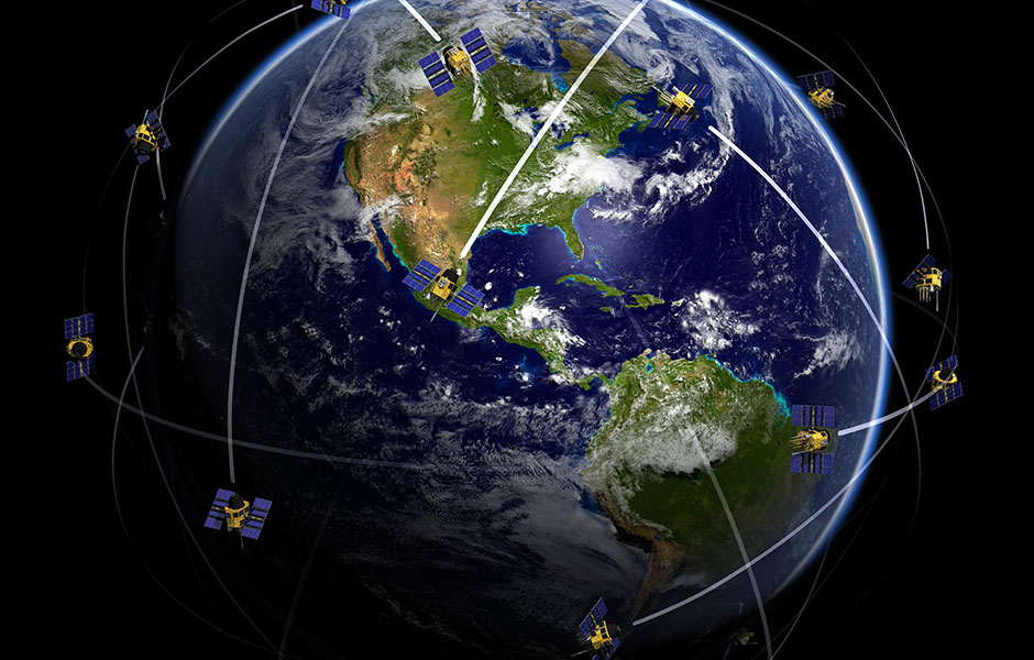
Introduction to Geospatial Technology Geospatial technology represents a revolutionary approach to understanding and interacting with our physical world. At its core, this technology combines Geographic Information Systems (GIS), remote sensing capabilities, and sophisticated spatial data analytics to create powerful tools for visualization and analysis. In Nigeria, these tools are becoming increasingly vital for infrastructure planning and development. GIS systems serve as the foundation, allowing users to capture, store, manipulate, and visualize geographical data in ways that reveal patterns and relationships that would otherwise remain hidden. When combined with remote sensing—which collects data through satellite imagery, aerial photography, and ground-based sensors—it creates a comprehensive picture of both natural and built environments across Nigeria’s diverse landscapes. The real power of geospatial technology lies in its ability to provide spatial intelligence. By analyzing the relationships between location-based data points, decision-makers can gain insights that drive smarter urban development. This means government agencies and private developers can make evidence-based decisions rather than relying on outdated methods or gut instinct. For a rapidly urbanizing country like Nigeria, these capabilities couldn’t come at a more crucial time. With cities expanding at unprecedented rates, geospatial tools help planners understand population movements, infrastructure needs, and environmental impacts before breaking ground on new projects. Current State of Infrastructure Development in Nigeria Nigeria faces significant infrastructure challenges that directly impact economic growth and quality of life. The country’s infrastructure deficit extends across transportation networks, power generation, water supply systems, and telecommunications—all critical components for national development. Land use management remains particularly problematic, with informal settlements growing faster than planned developments in many areas. Population growth compounds these issues, with Nigeria projected to become the world’s third most populous country by 2050. This demographic pressure alone creates enormous demand for new infrastructure that must be strategically planned and deployed. Traditional approaches to infrastructure development have often failed due to inadequate information about existing conditions and future needs. Data-driven strategies using geospatial analysis now offer a pathway to overcome these limitations by providing clear, actionable insights about where infrastructure is most needed. Geospatial analysis brings unprecedented clarity to market dynamics and infrastructure accessibility. For example, mapping existing road networks against population density reveals transportation gaps that limit economic opportunity. Similarly, analyzing water access points against settlement patterns highlights areas of critical need for new water infrastructure. Key Applications of Geospatial Technology in Infrastructure The practical applications of geospatial technology in Nigerian infrastructure development span multiple sectors. In urban planning and land use management, GIS tools enable accurate zoning, continuous monitoring of land use changes, and rapid detection of unauthorized developments that could compromise planned infrastructure corridors. Transportation management benefits enormously from geospatial analysis. Traffic flow optimization relies on accurate mapping of congestion patterns, while public transport planning leverages population density maps to identify optimal routes and station locations. The logistics sector also uses these technologies to plan efficient delivery routes and distribution centers. Resource management becomes more strategic through geospatial tools. Water distribution networks can be planned to minimize waste and maximize coverage. Similarly, electricity infrastructure planning benefits from precise mapping of demand centers and potential renewable energy sources. Perhaps most critically, geospatial technology enhances disaster management capabilities. Risk mapping identifies vulnerable infrastructure and communities, enabling preventative measures. During emergencies, these same tools support early warning systems and coordinate response efforts to protect critical infrastructure and human life.